Tuesday, August 18, 2020

Archbishop Fiorenza Park


Main area with parking lot

 It was a beautiful, overcast and cool morning, so I headed Northwest from my house, not that easy when you are avoiding main roads.   I did a lot of right-left-right, etc turns from neighborhood to neighborhood and only spent two blocks on Synott (my wife pronounces it snot, go figure) before turning into Archbishop Joseph A. Fiorenza Park, located on West Park, between Hwy 6 and Eldridge Parkway.  This is one of many nice parks in Alief.

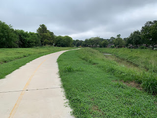
One of my e-maps shows the Southern trails to be future, but all trails exist and are asphalt and fairly smooth.    There are two man-made hills here, my 7 speed Schwinn and I avoided them, but I guess you can get a workout if you want one.    There are also exercise stations along the trail, Dan was doing well just to pedal!   Maybe next time!


Archbishop Fiorenza Park is part of Brays Bayou.  It and several other parks West of Beltway 8 have been built to give Brays Bayou a place to rest during flood events so that my friends down stream don't get flooded so often.   Brays Bayou crosses under Hwy 6 and flows into the lake that the park was built around.   A trail branches off from the park, goes under the highway and follows Brays Bayou West for some distances.   I will take this trail some other time.

At a scenic spot on the back end of the park, I found this swinging bench.   I tried to get a selfie, but I guess I am too old for selfies!   It's rather comfy!

The parking lot, playground, and clean restroom are on Westpark Dr, just West of Eldridge Parkway.   This might be a good place to park and ride, if you want to continue on to McClendon Park and even farther.   Bring your own water.   Both water stations I saw were out-of-service.

This might be a good time to discuss who runs this park.   Harris County Precint 3  is responsible for parks all over West Harris County.  Because of gerrymandering, Precint 3 is also responsible for Brays Bayou Greenway Trail from Gessner to the railroad tracks west of Stella Link    Other agencies who also control parts of these trails include Precinct  1, which has a small sliver just west of Gessner, and a good bit of trail east of the railroad tracks. The City of Houston (Keegans Bayou) and probably other groups I have not seen.

Steve Radack, commissioner of Precinct 3, has more constituents (population) than the governors of about 10 states.   He has almost total control of the budget for roads, bridges and parks in our precinct.   See www.pct3.com     An interesting fact is that our state constitution established that each county (I have visited all 254) is governed by 4 county commissioners and a county judge, regardless of size or population.   Loving County has about 100 residents, Harris County about 4.7 million!  Go figure.

   Commissioner Steve Radack has been in office for three decades.    His name is on park signs and county structures all over West Harris County.   At www.pct3.com, I found parks, dog parks, trails, community centers and two senior centers.   All carry his name.  An older park, just across the street from "Archbishop Joseph Fiorenza Park" is "Bishop Joseph Fiorenza Park", and the sign was cast of concrete,   I guess, long before Steve Radack was elected, because his name is not there!The park page on the pct3 site shows this as phase I with the bigger park as phase II.  A sign that I wonder about are the numerous signs that warn of alligators!   Maybe why they say no swimming.

Two other places, that Dan thinks SHOULD have Mr. Radack's name on it, are the signs at the toll booths announcing a toll of $1.75, and in front of the empty Astrodome, but now I'm just bellyaching!   Mr. Radack was responsible for a world class soap box derby track, and a permanent home for Houston Area Live Steamers (HALS.org)  in Zube Park.  Mr. Radack is not running again, so I wish him well.

My ride in the park was very nice.   The  trail is patched asphalt and is not near as wide as the more heavily traveled main trail along Braeswood from Gessner to Mason Park, but was scenic and restful.   Next time, I think I will drive there and bike farther west along a part of Brays I have never seen. 


Saturday, August 15, 2020

Riding East from MacGregor Park

 My friend Don and I drove over to MacGregor Park, off of MLK Blvd and just South of University of Houston.  We took the bikes down from the car and headed East.    Note to everyone:  MacGregor Park offers parking right by the trail.  Also available are restrooms (presently clean porta-potties), water, and A B-Cycle station, so if you want to rent a bike, you certainly can.   This portion of Brays Bayou Greenway Trail is fairly new; Google maps still show bare earth in many places.   I wanted to see this first hand as the trail dips down under the Metro line and does a cloverleaf up and over the bayou to a beautiful entrance to University of Houston.   By the way, right by the corner of UH is the fifth air pump/bike maintenance post that I have seen on Brays Trail.    Air the tires before you go much farther.  This is a great idea, and I imagine this is part of our tax dollars at work, but it, and the occasional water stations, sure make for a nicer ride.

We were curious, as several of my online maps, and the city's trail map, show several points on the trail, that go under road bridges, to be closed for construction.   The suggested detour is over 3 miles long and takes one along Hwy 90a (Wayside) North of Gus Wortham Golf Course before you get a chance to get back to the trail.   Now, I am a law abiding citizen (mostly) and I have been known to do what I am told, but as a Texan, if you don't want me to drive down a perfectly good road, you better dump a load of dirt in my way or dig a big hole, or both, or I am going right around all those "road closed" barriers, which I did.    

The first signs, around Telephone Road were bypassed, with no adverse affects.   There was no construction (on the way back I could see piles of dirt, etc on top of the bridge, so.....) and we sailed right along.    This part of the bayou looks rather natural, not a lot of concrete embankments and a serious effort is being made to grow native grasses.

The second set of barriers was a different story.   The Lawndale bridge over the bayou has been torn down and construction really is ongoing.   Did that stop us?   Nope.   We took a short detour left, then crossed Lawndale, intending to follow it West and around the golf course, but we spotted a family going around the construction on the other side of the street, so we bumped over a little dirt and followed them back to the pathway.   Not crowded (many people minded the signs, I guess)  and we rode on to Mason Park.   There are two bridges that will take you to the South side of the bayou and to Mason Park.   This is an old city park (est 1929) and actually has something that resembles terrain!  One of the bridges has a dedicated bike lane, the other is an architecturally interesting foot bridge.   We biked to what is truly the end of the trail..    A railroad trestle stands in the way, but work is being done to rebuild the railroad and extend the trail several hundred feet to a final section of the trail that is pretty much not accessible at this time.

So, with just a little caution, you really can ride from Braeburn Glen Park off of Gessner (parking) all the way to Mason Park    One more piece of the trail, and we really will be able to ride all the way to Buffalo Bayou!    And, I read that work should start this year (sure it will) on the Brays trail Northwest of Bissonnet, on to Arthur Storey Park, and maybe, on to Hwy 6 (several parks along the way already).

This is a well maintained trail, a little bit of ups and downs (as a 67 year old fat boy, I need to learn how to effectively use these gears!) and the scenery is quite nice.    I am pretty sure the bayou at this point is either brackish, or its salt water, as this ditch empties into the ship channel in about a mile, which would put this at sea level.     I saw one spot marked as a place to launch a canoe.   

Here, in the midst of a great urban area, and close to the super-busy ship channel, you can still see nature.   Wildlife


and not so wildlife.


Sunday, August 9, 2020

Back to Cullinan Park

 My friend Don took Brays and Keegans Trails to my house this morning.   After a breakfast of coffee cake, eggs and bacon, we headed, via residential streets to Cullinan Park, just North of the Sugar Land Airport.   This was our second bike visit to the park.  A very enjoyable part of the ride is the Imperial development North of Constellation Park.   Lots of green space and many well-maintained paths.   

The picture of the deer was taken earlier this week, from my car.  Mommy and two fawns were not more than 50 feet from me, along the main road into the park.   They never bolted, but I was being watched as much as I was watching them.  This scene is less than a mile North of the airport, within the city of Sugar Land.

I thought we had learned our lesson the last time we were there, so we set out to follow established trails with markings and the occasional sign.   Sure.   What could go wrong?   Wide, civilized paths suitable for senior citizens quickly gave way to narrow tracks through and around saplings.   It was thoroughly enjoyable, but I did rededicate my life when we got back to the parking lot.   I don't have a picture of the blind, hard-left turn that dropped about 6 feet and ran across a rickety plank bridge.   Apparently, they couldn't afford railings, or for that matter, trimming of the underbrush.   Those of you who do not remember when bikes made-in-America will probably say "Again!"


I did take comfort in knowing there was a limit to how lost we could get, as the map showed water along several boundaries of the trail area, and I had not brought the floats for the bikes.  Sure enough, as we thought we were totally lost, we pedaled around a corner and found ourselves back at the main area.   

The website for the park and the conservancy offer maps and a glimpse at some rather ambitious plans.   This is a nice park that is close to civilization.

https://www.sugarlandtx.gov/Facilities/Facility/Details/Cullinan-Park-64

Thursday, August 6, 2020

Along Brays Bayou

I made a major goal Tuesday.    From my house in Alief  (Southwest Houstonm, outside the Beltway) , along Keegans and Brays Bayous, to MacGregor Park just South of University of Houston is 20 miles.    292 pounds of 67 year old couch potato made it!  MacGregor Park is one of the few spots along Brays Bayou with parking for those who DON'T live just a few blocks from one of these bayou greenways trails.   You can bike through the park, play in a pickup game of roundball, or bike on through the park and on farther down stream on the bayou.

Just a small mention of the Covid-19 mask.    My wife ordered me a set that are specifically for athletic endeavors.   Replaceable charcoal filters.   I can actually breathe while wearing one.   We won't mention that my wife recently found a review of said mask that said they are pretty much useless, because the inlet ports that give me enough air also move unfiltered air in AND out.   As Scarlett said, "I'll worry about that tomorrow, at Tara.   After all....."    

Between Texas 288 and MacGregor Park is a little bit of construction (eventually all bridges across the bayou will be rebuilt for flood control/survival), and a whole lot of very stately homes from many years back.   I smell old money.   The Brays Trail runs along both sides of the bayou.  On the South bank of the bayou, almost to MacGregor Park, is a high-quality exercise pavilion with bike racks, water, and a number of exercise stations.   Technically, it's closed because of the Pandemic, but.....   There are two foot bridges for bikes, so you can go down one side and come back on the other.  The Westernmost bridge is part of Colombia Tap Trail.   There is construction here right now.     I ignored the detour; probably shouldn't have.


Columbia Tap Trail just South of Brays Bayou Trail.    If you head South, across 288, and turn right, you can take a quiet city street to Parks and Recreation @ Brays Bayou.


There is a new H-E-B at the corner of Brays and 288.  At the corner by New Hope Baptist Church (historical marker) is a stop for Bus 4 that can take you to the TMC transit center and all the way the other end of Alief.   $1.25 

There are two Metro stops close to MacGregor.   I wanted to bike to the one adjacent to UH, but the trail does a cloverleaf down and up (which is cool) and my legs rebelled against even that slight incline by this stage of my journey, so I boarded at MLK @ Old Spanish Trail.   Went two stops, by the stadium and rode a block to my bus stop at Scott and Alabama, where, by the way, someone has placed something called "Rookies Cookies!"   I managed to avoid it - this time, but I see a side trip in my future!   Makes sense doesn't it?   End a 20 mile ride with ice cream and cookies!   Ask me why I can't lose weight!

Not sure how much farther we can go at the present time.   Website maps show Brays Greenway Trail is closed at Hwy 90a and the detour is not something I am interested in.   The problem with world class bike trails  -  it can be a mess building them., and the mess is there for some time.   I am considering driving to MacGregor and doing a fairly short exploration of the bayou from there.


Tuesday, July 28, 2020

A little farther on Brays Bayou Greenway Trail

I headed out Friday morning.   I would have gotten out earlier, but the dogs demanded a walk before they would let me get on the bike.   Weather Wife predicted rain by 1:00.    Had to turn around after a block because my Covid mask was still in the house.  I stopped a lot to take pictures for the previous post, and that added to my time.    And then the headwind.   Now, the guys with 5% body fat, on the fancy bikes, don't seem bothered by wind; me, I was bothered, but I kept going.

The portion of Brays Bayou Trail between Gessner and Buffalo Speedway is very pleasant.   The bikers, runners and walkers come in all shapes and sizes, and are a very diverse group.   Some are in a hurry, many are out enjoying the view.     Everyone is nice and there are many places to rest.

I have counted 3 of these maintenance stations, so far.    Bicycle tools on cables, and a sturdy air pump.   This is just downright friendly of Harris County, or whoever put them there!


After Buffalo Speedway, the grass turns into concrete and the trail moves into the concrete canyon that is Brays Bayou in the Medical Center.   I saw no more families, and traffic thinned out, which is good because the trail is a little narrow, and just a bit closer to the down-embankment than I like.


 Then, we're opposite Hermann Park, and the trial sweeps left and right, and up and down.   Note - if you want to cross the Bill Coats Bridge, and it is beautiful, as is the other side, better take the higher trail as you go under Cambridge, as that is about your only chance.   There is a lower trail at water level, as you go under Texas 288; I was glad I passed on it, as I could see the water had taken over at one point.

Just past 288 is a new H-E-B.   I may stop there sometime.    The next landmark was what I had been looking for - Columbia Tap Trail crosses the bayou here.   If you turn North, this new trail will take you all the way to BBVA Stadium in EaDo.   This is a Rails-To-Trail.   It's an abandoned rail line and goes right through TSU and the 3rd Ward.   I must try it some day - after I finish Brays!


I stopped here and parked my bike at the corner by New Hope Baptist Church.   Bus Line 4 stops here and will take me back through the medical center and all the way back to Alief, all for $1.25! 

My next goal is MacGregor Park, where Brays Bayou crosses MLK and the Metro Rail.   This may take a while.  I feel like I've made progress.   In early May, I rode 2 miles.   Friday, July 27, I rode 18 (at least) miles)

Your Homework assignment for next time - Why is it Brays Bayou, but Braeswood? 

Keegans Bayou Trail

Keegans Bayou Trail is my gateway to Brays Bayou Greenway Trail.  The current trailhead is at Kirkwood and Keegans Bayou, just North of West Bellfort.   The City's master plan for bikeways will extend this trail West to Synott.     Doing so will bring the trail through my neighborhood, but the $64 question is WHEN?   The current trail, according to Houston Parks and Recreation, is 4.04 miles from Kirkwood to Gessner, where it joins Brays.

Trailhead, Kirkwood, just north of West Bellfort.


If you enter Keegans from Brays Trail, you will go under Gessner and seamlessly start on your 4 mile journey West.   I have read that Keegans is an extension of Brays; it's really supposed to be a branch.   To continue on Brays Trail, take the upper trail and cross the bridge at Gessner, then turn left onto the North bank of Brays.   Don't get excited when you see the sign pointing towards Arthur Storey Park, the sign guy got his work done a little faster than the trail builder.   The trail ends abouit 2000 feet from Gessner, at Braeburn Glen Park.    Bus 65 crosses the trail here at Bissonnet.   More about trails and busses another time.   My point is that eventually (I'm 67 yrs old, don't have much more time) Brays Bayou Greenway Trail could follow the bayou all the way across Alief.   There are several parks built around detention ponds, including Arthur Storey Park, but right now, as they say in New England, "Ya cahnt get there from heah!"  Hopefully they will all become part of the master plan.

The vast majority of Keegans Trail is an eight foot wide ribbon of concrete.   Nice.   But the city must have run short of funds at some point, as there is a segment just east of Wilcrest that is crushed granite.   Still nice, but a little prone to ruts.   On the other hand (where I have 5 fingers) this little stretch is quite scenic, isn't it?   There are turtles and all manner of cranes, heron, etc.   Just try to look past all the trash in the bayou, and the bags someone left along the trail.   We Houstonians are a trashy lot.


The part that goes under Southwest Freeway is a little disconcerting:  it's a small homeless colony, but they have never bothered me, nor I them.  Just know you may see legs sticking out of a tent up under the roadway.   Also, this part of the bayou could really use a work day or two.


I read some past complaints about this trail; but I think the city has fixed it up pretty nice.   There can be a little mud on the trail after it rains, but keep in mind the primary purpose of this property is flood control.    The city has been fairly regular this summer about mowing.   If you want quiet, and not well traveled, you are home.   There is not much access to the trail from neighborhoods between Braeswood and Wilcrest, so most traffic will be those who are going more than 4 miles.  


There are four rest areas on the 4 mile long Keegans Trail.   Very quiet and restful.

About a mile into the trail from Gessner, is Riceville Cemetery.  When I first came across it several years ago, the trail was new and there was no fence arounc the cemetery.   There is a nice one today, and the gate across the way is locked.  This and Riceville Mt Olive Baptist Church seem to be about all that is left of Riceville.   This African American community, founded by Leonard Rice in the 1850s was annexed to Houston in the late 1960s.   As late as 1982, there were no city services, no public water or sewers.   There were about 300 residents.   -  Handbook of Texas

  My aunt and uncle lived less than a mile from here, and I never knew it existed.    The foot bridge moves the trail from one side of the bayou to the other.   There is also a minor trail to the South that ends in a neighborhood.

By the way, if you go all the way to Kirkwood, you might want to check out the El Rancho Grocery.  It's what we got when Randall's closed.   They have an extensive collection of prepared Mexican dishes.  In the same center is Boba.   They open at 11:00 and offer a real good Mango Smoothie with popping bobas.   Don't ask, my granddaughter told me what to order.


Sunday, July 26, 2020

Alexander Hodge, American Revolutionary War Veteran

While my friend Don and I were lost in Sugar Land's Cullinan Park (remember we had become accidental BMX riders) we stumbled (almost literally) apon a rustic old cemetery on the Northwest edge of the park.   We stayed on the edge of the cemetery as I do like to respect the dead.   As we caught our breath, I could see a street sign for Old Richmond Road on the other side of the plot of land.   I resolved to do a little research.    Many of the markers are wooden crosses close to six foot tall.    There are a couple of tombstones, but the place does not look real well kept.  Was this another prison cemetery? 

That afternoon, I did a little research, and then drove back to the cemetery.

Hodge's Bend Cemetery is on land settled by Alexander Hodge, one of Austin's Old 300 settlers.  He brought his family to Texas in 1825 when he was about 65 years old.   His sons fought in the Texas Revolution.    Alexander, his wife and many of his descendants are buried here in Hodge's Bend Cemetery, on Old Richmond Road, just outside Sugar Land city Limits.  These were some of the earliest Anglo settlers of this area, and of Texas.

What really makes him interesting is that Alexander Hodge, while still in his teens in the late 1770s, fought in the American Revolutionary War with Francis Marion, known to all of us 1950s Disney fans as - The Swamp Fox.  Their exploits and successes are legendary, and Fort Bend County, Texas is the final resting place of one of those soldiers.


Had we not gotten way off the planned route, we would never have seen this.

By the way, Spell Check and I fought with each other all the way through this little story.   Apparently, there is no "A" in "cemetery"    Who knew?

Saturday, July 25, 2020

Sugar Land and Cullinan Park

Friday morning, my friend Don, and I headed from Huntington Village (Alief, Dairy Ashford) to Sugar Land.   This is a vary pleasant bike ride through quiet neighborhoods, all the way to Highway 6. there is a gap in Huntington Estates Dr, but a short ride on the grass will put you in Barrington Place, Sugar Land.

I always enjoy riding throuh Barrington Place as a speed limit sign will check my speed for me!  A little farther on was a mosque that showed we are all pretty similar

Our Baptist preacher had told us if we don't maintain social distance, he will turn this car around!

We always stop in Sugar Mill Park for water, and to watch the ducks.   It's also fun watching the toddlers and pre-schoolers try to feed/chase the ducks!

One of our favorite segments is the wonderful concrete trails in Imperial, the development that include Constellation Field.   Nicely curving, wide, sidewalks, with numerous signs warning of alligators!

Speaking of alligators, we crossed Oyster Creek and headed across Highway 6, North of Sugar Land Airport, and into Cullinan Park, a hidden gem inside suburbia.    I had seen a trail on Google Maps, so we swung onto a very scenic concrete trail that gently swept around the Southeast edge of White Lake.    Somewhere along the line, the trail narrowed to crushed granite, but was still quite navigable for this old fool.  There are little signs that advise you of the flora and fauna of the woods.   Suddenly, we found ourselves on a trail that would be a delight to some 13 year old BMXer, but which was rather frightening to a 67 year old biking neophyte.   I think I re-did my will in my head, and re-newed my relationship with Jesus, as saplilngs jumped in my way, and someone had routed the trail up and over a log by means of not-quite-enough little planks.  There was a definite feeling of being lost in the piney woods, except that clearings would always reveal a cell tower across the lake, and all along  the northern edge of the park, we were usually about 100 feet from a Sugar Land neighborhood.   But we kept going, and eventually found a trail that looked like it had been designed by park personnel, which led us back to the lake's observation point.   This is a very nicely done series of raised boardwalks over a lake that is over-growing with lilies and other water plants.   We saw a family of ducks, pretty common, but while momma was swimming, the ducklings were jumping from water lily to water lily!   Kids are kids!

Next blog will cover the cemetary we found on the Northwest side of the park.   Stay tuned.

Dan

Monday, July 20, 2020

Brays Bayou Trail for the Beginner

Brays Bayou Bike trail has become part of my life goals.    I started riding just a few months ago when my bathroom scale reached 300 pounds and my doctor complained (always something!) about my blood pressure.    So, I dusted off the $200 7 speed Schwin, aired it up, and headed to the beginning of the Keegans Trail.   That was two miles, one way.   Over the next few weeks, I went a little farther each time, until it was time to push on to Gessner where Keegans Trail joins Brays Bayou trail.   At this point, my goal became going as far down Brays as I could, and then I stumble over to the nearest bus stop where I ride Bus 68 West towards home. 

My first major goal was the Medical Center transit center.  I worked towards this goal since early May, but last week I had a great ride and blew right past it, finally stopping at Almeda, and got onto Bus 4, which took me deep into Alief where I live.    If you have ever wondered whatever happened to AJ Foyt, he drives an articulated omni bus on line 4!

So, my next goal is MacArthur Park, just Southeast of University of Houston.   I'm still researching the best bus route home, but sometimes I turn around in Meyerland and ride on back home.  I did that today, and the map says I accomplished 18 miles!   Compare that to my May 5 entry that says I rode 2 miles!

On the Brays Trail, I see all manner of walker and cyclist.   I see teams in matching T's, families with strollers and even a trailer behind Daddy's bike.   The most intimidating is not the ripped guy with spandex and the graphite bike who blows past me on rocket assist, but rather the little 5 year old on the 16 inch bike, who Daddy reports can ride 10 miles!    Way too much energy!

Dan